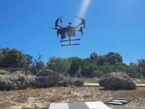
Have you noticed a drone buzzing over the corridor over the last few days and wondered what we were up to?
A specialised drone operator has been capturing high resolution near-infrared and RGB imagery over the corridor for us. This is the third year in a row of collecting these images. Using special software, we can then easily compare changes to vegetation cover, height and health over the last years. This data shows us how well the different revegetation areas across the corridor are regenerating and also highlights which areas might need some extra help, for example additional seedlings planted in the coming years.
Pretty exciting, isn’t it?! We can’t wait to see the results!